Louise E. Keir WMA – Albany
Gas Springs State Forest – Allegany
Hanging Bog WMA – Allegany
Karr Valley Creek State Forest – Allegany
Phillips Creek State Forest – Allegany
Mccarthy Hill State Forest – Cattaraugus
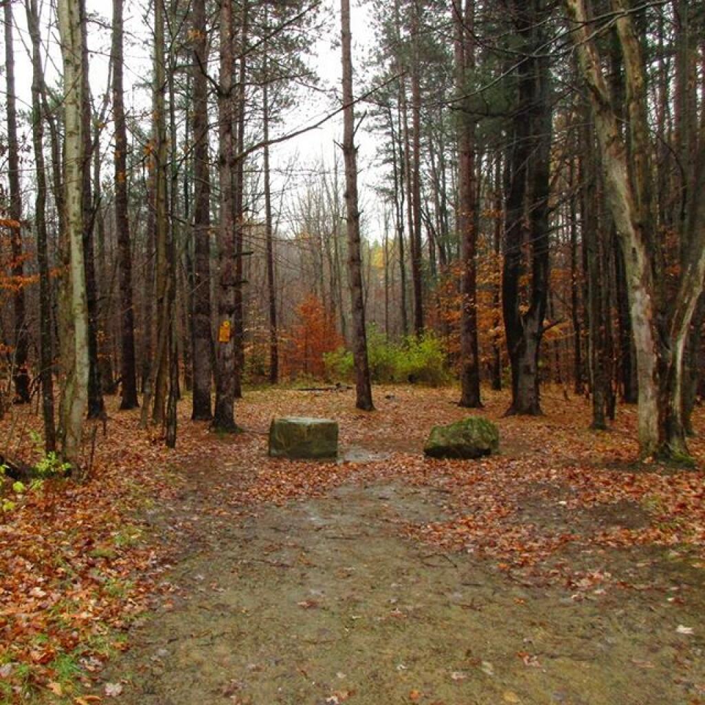
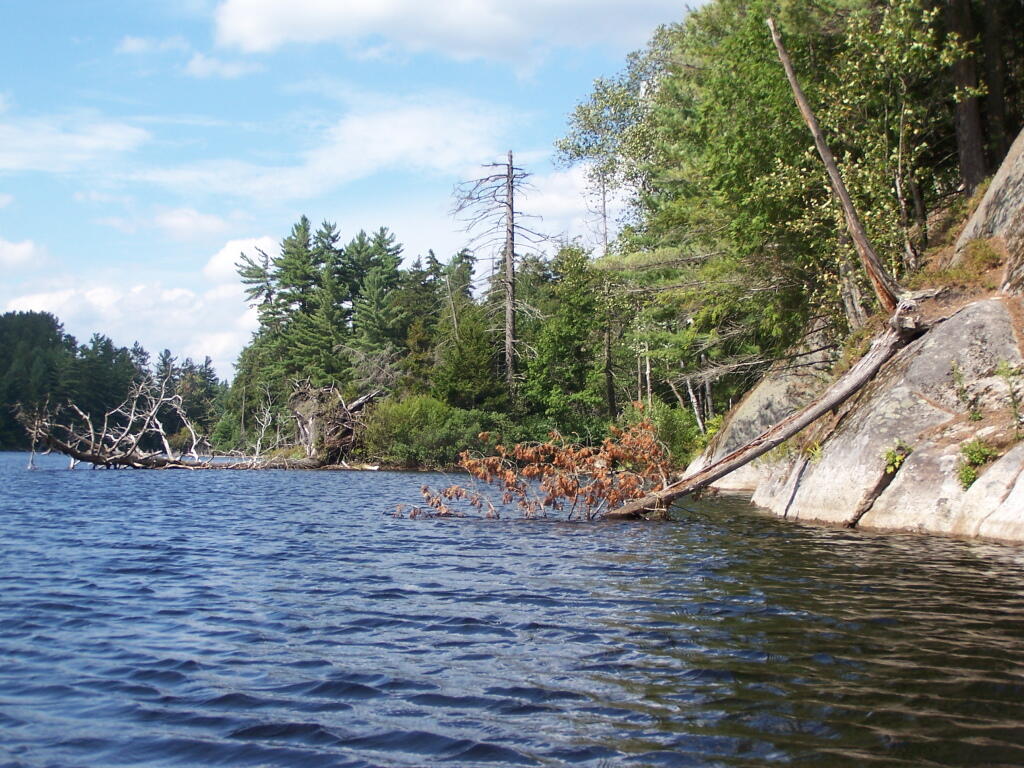
Rock City State Forest – Cattaraugus
Frozen Ocean State Forest – Cayuga
Whalen Memorial State Forest – Chautauqua
New Michigan State Forest – Chenango
Perkins Pond State Forest – Chenango
Mariposa State Forest – Chenango-Madison
Macomb Reservation State Forest – Clinton
Livingston State Forest – Columbia
Taylor Valley State Forest – Cortland
Trout River State Forest – Franklin
Beartown State Forest – Lewis
Frank E. Jadwin State Forest – Lewis
Grant Powell Memorial State Forest – Lewis
Indian Pipe State Forest – Lewis
Sand Flats State Forest – Lewis
Charles E. Baker State Forest – Madison
Popple Pond State Forest – Oneida
Rome Sand Plains Unique Area – Oneida 1
Huckleberry Ridge State Forest – Orange
Roseboom State Forest – Otsego
Gates Hill State Forest – Schoharie
Petersburg State Forest – Schoharie
Sugar Hill State Forest – Schuyler
Brasher State Forest – St. Lawrence
Helmer Creek WMA – Steuben
Calverton Pine Barrens State Forest – Suffolk
David A. Sarnoff Preserve – Suffolk
Otis Pike Preserve – West – Suffolk
Rocky Point Pine Barrens State Forest – Suffolk
Bashakill WMA – Sullivan
Hickok Brook State Forest – Sullivan
Mongaup Valley WMA – Sullivan
Roosa Gap State Forest – Sullivan
Wolf Brook Multiple Use Area – Sullivan
Wurtsboro Ridge State Forest – Sullivan
Hammond Hill State Forest – Tompkins
Potato Hill State Forest – Tompkins
Witch’s Hole State Forest – Ulster
Search Results for: Rock City State Forest
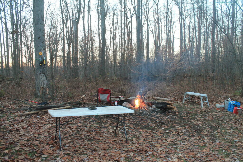
There are 80 designated campsites in Cattaraugus County in following state forests
There are 80 designated campsites in Cattaraugus County in following state forests …
Cattaraugus County State Forest Maps
This listing provides the total number of campsites in each forest along with a link to map and photos of forest.
Cattaraugus County Campsite Coordinates
Here is a listing of the individual campsites. The road indicates the nearest road, links on state forest go to DEC website for more information, while the location link takes you to ACME Mapper to see the exact location …
How Much Recreational Development is Allowed in the Forest Preserve?
Most people probably agree it’s not the intent of the original drafters of the state consitution to allow totally unbridled development in the forest preserve. Article XIV Section 1 of the State Constitution states:
The lands of the state, now owned or hereafter acquired, constituting the forest preserve as now fixed by law, shall be forever kept as wild forest lands. They shall not be leased, sold or exchanged, or be taken by any corporation, public or private, nor shall the timber thereon be sold, removed or destroyed. [… exceptions removed]
It’s pretty clear that on Forest Preserve lands that the following is totally inappropriate:
- Commerical facilities, such as shopping or amusements.
- Government facilities that are not primarily rustic in character (i.e. wooden administrative cabins and barns that lack plumbing and electricity)
- Highly developed recreation facilities, such as large metal or concrete luge tracks, ski slopes
- Asphalt roads, and those roads designed for movement of vehicles not exclusively for the forest preserve use, or for speeds greater then 25 MPH.
Controlling Principles Of Recreation in the Forest Preserve.
I think most people can agree forest Preserve must have an essentially wild character. Indeed, that is what the Court of Appeals upheld in Association for Protection of Adirondacks v MacDonald (253 N.Y. 234, affg 228 App Div 73, 1930), as I shared earlier this week. If you missed this earlier in the week, this case’s essence is cited in Balsam Anglers Club v. DEC (153 Misc. 2d 606, 1991).
Respondents adopted the UMP in furtherance of the Catskill Park State Land Master Plan, which was adopted in order to provide classifications and guidelines for the uniform protection and management of State-owned lands within the Catskill Forest Preserve. Under the UMP, respondents intend to construct a number of small parking areas providing access to trails and primitive campsites, to relocate certain trails to avoid private lands and to construct new trails within the Balsam Lake Mountain Wild Forest area. Since respondents must necessarily cut a certain number of seedlings, saplings and trees to complete such projects, petitioner contends that the UMP is in violation of article XIV, § 1 of the New York State Constitution. p>The Constitution provides, “[t]he lands of the state, now owned or hereafter acquired, constituting the forest preserve as now fixed by law, shall be forever kept as wild forest lands. They shall not be leased, sold or exchanged, or be taken by any corporation, public or private, nor shall the timber thereon be sold, removed, or destroyed.” Petitioner contends that the cutting of as many as 2,000 “trees”, most of which are less than three inches diameter at breast height, constitutes the removal or destruction of timber.
This specific constitutional issue has rarely been litigated. The Court of Appeals and the Appellate Division in Association for Protection of Adirondacks v MacDonald (253 N.Y. 234, affg 228 App Div 73) addressed legislation authorizing the construction of a bobsled run within the Adirondack Forest Preserve for the 1932 Winter Olympics.
The Appellate Division addressed the legislative history of the New York State Constitution and found an intent to prevent any actions “which might convert this preserve into anything but a wilderness” (228 App Div, at 79). However, the Appellate Division found that the framers of the New York State Constitution obviously distinguished between “timber” and any form of tree or wood. They quoted the framers as stating, “[a]ny campers that cannot pick up something on the shores, that will not be timber, to warm themselves with, would better either carry in their fuel or stay out” (supra, at 78). (emphasis added)
The Appellate Division also discussed the 1915 Constitutional Convention which sought to change the wording of the New York State Constitution to “trees and timber” (supra, at 79). Thereafter, the Appellate Division found that the project involved “the cutting of 2,600 trees which must unquestionably be regarded as of `timber’ size” (supra, at 82).
Based upon an 609*609 agreed statement of facts, all 2,600 trees were in excess of 3 inches diameter at breast height, 480 trees were in excess of 8 inches and 33 trees were in excess of 20 inches. The project involved total clearing of between 4 and 5 acres, some of which constituted first growth hardwoods and involved the removal of some 60,000 board feet of timber. The Appellate Division held the legislation unconstitutional based both upon the substantial destruction of timber and the nature of the proposed project.
The citation of Helms v. Reid, 90 Misc. 2d 583 gives further incite into the Assocation for the Protection of Adirondacks vs McDonald case:
The major case interpreting the “forever wild” clause is Association for Protection of Adirondacks v MacDonald (228 App Div 73, supra). The question before that court was whether a statute passed by the Legislature providing for the construction of a bobsled run on forest preserve land and the necessary cutting of some 2,600 trees was violative of section 7 of article VII of the Constitution (presently art XIV, § 1). The Appellate Division had carefully traced the adoption of the forest preserve language and then made a careful inspection of the record from the 1894 Constitutional Convention where the “forever wild” clause language was adopted as a proposed amendment to the Constitution. The Appellate Divison concluded that the constitutional mandate was clear and in declaring the statute unconstitutional stated at page 81: “Giving to the phrase `forever kept as wild forest lands’ the significance which the term `wild forest’ bears, we must conclude that the idea intended was a health resort and playground with the attributes of a wild forest park as distinguished from other parks so common to our civilization. We must preserve it in its wild nature, its trees, its rocks, its streams. It was to be a great resort for the free use of all the people, but it was made a wild resort in which nature is given free rein. Its uses for health and pleasure must not be inconsistent 595*595 with its preservation as forest lands in a wild state. It must always retain the character of a wilderness. Hunting, fishing, tramping, mountain climbing, snowshoeing, skiing or skating find ideal setting in nature’s wilderness. It is essentially a quiet and healthful retreat from the turmoils and artificialities of a busy urban life. Breathing its pure air is invigorating to the sick. No artificial setting is required for any of these purposes. Sports which require a setting that is man-made are unmistakeably inconsistent with the preservation of these forest lands in the wild and natural state in which Providence has developed them.”
What About Developing More Modest Recreation Facilities in Forest Preserve?
Certainly building a bob sled run would have been a massive project with visible impacts on the mountain vistas where the timber was removed, the steel infrastructure of the bob sled run, and the general changes the wild forest character. But what about more minor projects, e.g.
- Scenic Vista Cut Along Trails
- Primative tent campsites, along lakes, streams, or in the woods.
- Roadside campsites with vehicular access.
- State Campgrounds with Flush Toilets and Showers.
- Horse stalls and horse barns.
- Construction of hiking trails that require the cutting of brush or a de minis amount of timber.
- Construction of snowmobile trails that potentially could involve cutting a larger amount of timber.
- Horse trails that require the cutting of brush or a de minis amount of timber.
The Case Law on Recreational Facilities in the Forest Preserve.
We learn in Helms v. Reid, 90 Misc. 2d 583 some of debates surrounding adoption of Article XIV Section 1 of the State Consitution, and how the Consitutional Convention of 1894 intended not to prohibit “all things necessary” to provide public access and not damage the forst preserve.
The Court of Appeals decision in MacDonald is of great importance and must necessarily be the guiding light in the analysis of the “forever wild” clause which this court must follow in rendering its opinion. At page 238 Judge CRANE states: “The words of the Constitution, like those of any other law, must receive a reasonable interpretation, considering the purpose and the object in view. (State of Ohio ex rel Popovici v. Agler, 280 U. S. 379.) Words are but symbols indicating ideas and are subject to contraction and expansion to meet the idea sought to be expressed; they register frequently according to association, or like the thermometer, by the atmosphere surrounding them. The purpose of the constitutional provision, as indicated by the debates in the Convention of 1894, was to prevent the cutting or destruction of the timber or the sale thereof, as had theretofore been permitted by legislation, to the injury and ruin of the Forest Preserve. To accomplish the end in view, it was thought necessary to close all gaps and openings in the law, and to prohibit any cutting or any removal of the trees and timber to a substantial extent.”
This language sets forth that the purpose of the “forever wild” clause was to prevent the commercial exploitation of the forest preserve which had previously been sanctioned by the Legislature, and it appears to be the court’s feeling that some cutting is permissible as long as it is not a substantial amount. Continuing on page 238: “The Adirondack Park was to be preserved, not destroyed. Therefore, all things necessary were permitted, such as measures to prevent forest fires, the repairs to roads and proper inspection, or the erection and maintenance of proper facilities for the use by the public which did not call for the removal of the timber to any material degree.”
This language indicates the court’s recognition of the fact that even though the Constitution was intended to protect and preserve our natural forest lands, such protection does not prohibit use and enjoyment of the areas by the people of the State. Such a principle is based upon the theory that the forest preserve was for the use and benefit of the people and was not to be an isolated area in which no man would wander. (People v Adirondack Ry. Co., 160 N.Y. 225, affd 176 US 335). (emphasis added)
While the Court never ruled on these matters in Helms, plantiff Herbert R. Helms cited that the State Conservation Department, made major changes and “man-made improvements” to the Adirondack Forest Preserve, over the past 50 years, many of them of questionable consitutional virtue under McDonald, abit never challenged in court.
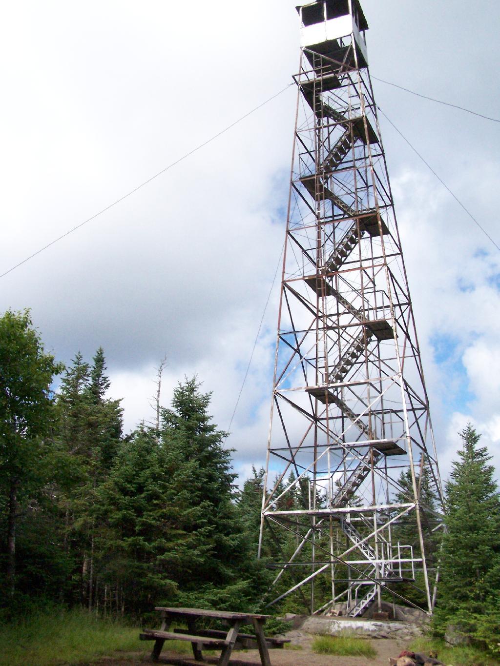
The first cause of action in the complaint sets forth the “forever wild” clause and then lists various uses undertaken within the forest preserve in the past and present by the New York State Department of Environmental Conservation (ENCON), which the plaintiffs contend destroy the wild forest nature of the preserve because they all entail cutting significant amounts of timber and over use of the forest preserve area. The purported misuses are as follows: construction of 42 or more public campsites; dirt access roads to these campsites, along with various outbuildings, facilities, boat launchings, sewage disposal systems and the maintenance thereof; construction of hundreds of lean-tos, trails, jeep trails, fire roads 587*587 and paved roads other than those specifically authorized by the Constitution; construction and maintenance of ranger stations, fire watch towers, telephone and electrical transmission lines, as well as other utility lines; construction of boat launchings, parking lots and tent platforms; overuse and misuse of backwoods causing unreasonable widening of trails, littering and defoliation of areas, and finally allowing private individuals to adversely possess forest preserve lands to the preclusion of other citizens.
Helms cites McDonald in saying limited development and recreation is allowed in the park, as long as it’s primarily primative in nature:
“What may be done in these forest lands to preserve them or to open them up for the use of the public, or what reasonable cutting or removal of timber may be necessitated in order to properly preserve the State Park, we are not at this time called upon to determine. What regulations may reasonably be made by the Commission for the use of the park by campers and those who seek recreation and health in the quiet and solitude of the north woods is not before us in this case. The Forest Preserve and the Adirondack Park within it are for the reasonable use and benefit of the public, as heretofore stated. A very considerable use may be made by campers and others without in any way interfering with this purpose of preserving them as wild forest lands. (See `The Problem of the Wilderness’ by Robert Marshall in `The Scientific Monthly’, Feb. 1930, p. 141.)”
Helms goes further to state:
If we assume that a constitutional amendment is not necessary for every use in the preserve which requires a cutting of timber, then we must apply our reasonableness standard to proposed uses. The question then becomes, who is to apply this standard?
It would appear that although the Constitution has deprived the Legislature of any power to authorize a cutting of timber in the forest preserve for commercial purposes, it has not deprived that body of its power with respect to public purposes. The MacDonald decision has allowed the Legislature the power to make reasonable regulations as to this public use and preservation, and such use and preservation must necessarily include some cutting of timber.
Since the Legislature still retains at least this limited authority, it may properly delegate this authority to the administrative agency best adapted to applying the principles heretofore enumerated. This is precisely what our Legislature has done by the creation of the Adirondack Park Agency. (emphasis added)
While ultimately Helms went on to decline an attempt to overturn float plane restrictions in newly designated “Wilderness” areas, first implemented by Governor Rockefeller’s Environmental Conservation Commissioner, Henry Diamond, it did include this important note:
In the discussion of the “forever wild” clause it was pointed out that the preserve was not to be closed to the public, but was to be held open for all of the public to enjoy in its natural wild state. Therefore, plaintiffs’ main theory is correct, and any regulation which arbitrarily restricts public access to or a reasonable public use of the lands in the preserve is violative of section 1 of article XIV.
The principle of limited development of the Adirondack and Catskill Forest Preserve, to enhance public access was upheld most recently in Balsam Lake Anglers Club v Department of Environmental Conservation (upheld on Appeal to 2nd Appelate Division). It states:
Respondents adopted the UMP in furtherance of the Catskill Park State Land Master Plan, which was adopted in order to provide classifications and guidelines for the uniform protection and management of State-owned lands within the Catskill Forest Preserve. Under the UMP, respondents intend to construct a number of small parking areas providing access to trails and primitive campsites, to relocate certain trails to avoid private lands and to construct new trails within the Balsam Lake Mountain Wild Forest area. Since respondents must necessarily cut a certain number of seedlings, saplings and trees to complete such projects, petitioner contends that the UMP is in violation of article XIV, § 1 of the New York State Constitution.
The Constitution provides, “[t]he lands of the state, now owned or hereafter acquired, constituting the forest preserve as now fixed by law, shall be forever kept as wild forest lands. They shall not be leased, sold or exchanged, or be taken by any corporation, public or private, nor shall the timber thereon be sold, removed, or destroyed.” Petitioner contends that the cutting of as many as 2,000 “trees”, most of which are less than three inches diameter at breast height, constitutes the removal or destruction of timber.
This specific constitutional issue has rarely been litigated. The Court of Appeals and the Appellate Division in Association for Protection of Adirondacks v MacDonald (253 N.Y. 234, affg 228 App Div 73) addressed legislation authorizing the construction of a bobsled run within the Adirondack Forest Preserve for the 1932 Winter Olympics. The Appellate Division addressed the legislative history of the New York State Constitution and found an intent to prevent any actions “which might convert this preserve into anything but a wilderness” (228 App Div, at 79). However, the Appellate Division found that the framers of the New York State Constitution obviously distinguished between “timber” and any form of tree or wood. They quoted the framers as stating, “[a]ny campers that cannot pick up something on the shores, that will not be timber, to warm themselves with, would better either carry in their fuel or stay out” (supra, at 78). The Appellate Division also discussed the 1915 Constitutional Convention which sought to change the wording of the New York State Constitution to “trees and timber” (supra, at 79). Thereafter, the Appellate Division found that the project involved “the cutting of 2,600 trees which must unquestionably be regarded as of `timber’ size” (supra, at 82). Based upon an 609*609 agreed statement of facts, all 2,600 trees were in excess of 3 inches diameter at breast height, 480 trees were in excess of 8 inches and 33 trees were in excess of 20 inches. The project involved total clearing of between 4 and 5 acres, some of which constituted first growth hardwoods and involved the removal of some 60,000 board feet of timber. The Appellate Division held the legislation unconstitutional based both upon the substantial destruction of timber and the nature of the proposed project.
The Court of Appeals in affirming the Appellate Division determination rejected the absolutist argument that not even a single tree or even fallen timber or deadwood could be removed and stated that the constitutional provision must be interpreted reasonably. “[A]ll things necessary were permitted, such as measures to prevent forest fires, the repairs to roads and proper inspection, or the erection and maintenance of proper facilities for the use by the public which did not call for the removal of the timber to any material degree. The Forest Preserve is preserved for the public; its benefits are for the people of the State as a whole. Whatever the advantages may be of having wild forest lands preserved in their natural state, the advantages are for every one within the State and for the use of the people of the State. Unless prohibited by the constitutional provision, this use and preservation are subject to the reasonable regulations of the Legislature” (supra, 253 NY, at 238-239). It is thus clear that the Court of Appeals determined that insubstantial and immaterial cutting of timber-sized trees was constitutionally authorized in order to facilitate public use of the forest preserve so long as such use is consistent with wild forest lands.
With respect to the relocation of the Hardenberg Neversink Trail challenged herein, petitioner contends that the amount of cutting is of constitutional dimension. The relocated trail is in excess of two miles long and is approximately six feet wide. With the trail approximately 80% completed, 73 trees of timber size, that is three inches or more, have been cut, including one nine-inch tree and one six-inch tree which was dead. The remaining trees are three, four or five inches in diameter. It is estimated by the court that the entire cutting, including trees not of timber size, that is, less than three inches, amounts to little more than one cord of firewood. The great majority of such cutting will be completely decomposed within a few years leaving no trace of their existence but 610*610 providing increased growth opportunity for the remaining trees in the forest.
It is therefore determined the amount of vegetation, seedlings, saplings and timber-sized trees destroyed so far in the construction of the relocated Hardenberg Neversink Trail is not constitutionally prohibited, nor is the number of trees planned to be removed to complete such relocation. While the actual route for the Millbrook Ridge Trail has not been chosen and it is not known how many trees, saplings, seedlings and other vegetation must be destroyed, it may be presumed that the Department of Environmental Conservation, pursuant to its regulations concerning the construction of trails and the destruction of trees and timber, will comply with the provisions of the New York State Constitution. In the event that the Department of Environmental Conservation does not comply, petitioner could certainly challenge the specific trail route or construction techniques at an appropriate time.
Petitioner also contends that the construction of new trails in the Balsam Lake Mountain Wild Forest area violates that portion of the New York State Constitution which requires that forest preserve lands “be forever kept as wild forest lands”, arguing that new trails will increase human activity, thereby necessarily making such areas less wild. Based upon the decisions of the Appellate Division and Court of Appeals in Association for Protection of Adirondacks v MacDonald (supra), it appears that the framers of the New York State Constitution intended not to prevent or hinder public use of the forest, but to allow forested areas to revert to their natural or wild state without human interference with the natural succession of different types of trees, selective cutting or thinning to “improve” the timber, or the harvesting of any mature timber. There is no indication of any intent to maintain the forest in an “absolutely” wild state with no organized human alteration or intervention at all.
The Court of Appeals specifically held that facilities consistent with the nature of the forest preserve could be constructed for the use by the public, including camping and hiking. Such use facilitated by the construction of new trails or increasing parking and camping areas will almost certainly degrade the pristine quality of certain areas of the forest preserve. While it may be desirable to initiate a policy to refrain from actions which will have the effect of increasing human activity, such issues are not of constitutional dimension unless significant cutting of timber is involved. Accordingly, it is declared that the Unit Management Plan adopted for the Balsam Lake Mountain Wild Forest area does not violate the provisions of article XIV of the New York State Constitution.
What is the Standard Held This Cases?
Over the years, the courts have created a certain principles on recreation facilities in Adirondacks. Distilled down, one can probably agree that courts in NY State hold:
- Any project to be constructed in forest preserve must cut as few trees as possible, particularly of timber-grade trees, those larger then 3″ in diameter. Any project requiring significant timber cuts are unconstitutional.
- There is a clear preference towards development of facilities in natural meadows and brushy areas, locating paths, trails, and roads on existing old woods road rather then cutting new roadways or trails through the woods.
- Limited timber cutting is allowed for essentially wild forest purposes, such as campsites and trail location. It must be as limited as practical.
- Any developed facilities must be rustic in nature (wood, painted brown), and must exist solely to complement forest preserve uses such as primative camping, hiking, hunting and fishing.
- Intensive use areas are allowed, such as developed state campgrounds or firetowers, but they can not change the forest character or require the excessive removal of timber.
… the courts have sought a balance between recreational demands and keeping the primarily wild nature of forests wild.
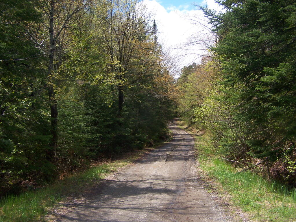
State Truck Trails and Forest Preserve Roads Over A Half Mile
Looking for state land to wheel on? This list shows all of the conservation department-maintained DEC truck trails and public access roads that are more then a 1/2 mile long. This roads are varied, but most of them are dirt roads that take you through the back country. Town maintained roads through state forests are generally not shown on in this listing.
| State Land | Road | Miles |
|---|---|---|
| Albert J. Woodford Memorial State Forest | Truck Trail | 0.7 |
| Albert J. Woodford Memorial State Forest | Janis Road | 1.1 |
| Aldrich Pond Wild Forest | Powell Road | 0.5 |
| Aldrich Pond Wild Forest | Mullins Flow Road | 0.6 |
| Aldrich Pond Wild Forest | Little River Road | 0.7 |
| Aldrich Pond Wild Forest | Silver Dawn Road | 0.7 |
| Aldrich Pond Wild Forest | Jackworks Trail | 1.1 |
| Aldrich Pond Wild Forest | South Creek Lake Road | 1.6 |
| Aldrich Pond Wild Forest | Tyler Road | 3.7 |
| Aldrich Pond Wild Forest | Streeter Lake Road | 4.8 |
| Allen Lake State Forest | George Forest Road | 1.5 |
| Ambler State Forest | Truck Trail | 1.8 |
| Ampersand Primitive Area | Ampersand Park Road | 3.2 |
| Andersen Hill State Forest | Big Pine Public Forest Acess Road | 1.5 |
| Arctic China State Forest | China Public Forest Access Road | 1.1 |
| Arctic China State Forest | Shears Public Forest Access Road | 2 |
| Arctic China State Forest | Dunbar Public Forest Access Road | 2.1 |
| Armlin Hill State Forest | Truck Trail | 1.1 |
| Arnold Lake State Forest | Public Forest Access Road | 0.9 |
| Arnold Lake State Forest | Hartwick Forest Access Road | 1 |
| Ashland Pinnacle State Forest | Ashland Pinnacle Access Road #2 | 0.5 |
| Ashland Pinnacle State Forest | Haul Road #1/Long Path Hiking Trail | 1.4 |
| Avon Regional Office | Goodlake Year Entrance Road | 0.7 |
| Baker School House State Forest | Baker School House Public Forest Acess Road | 1.8 |
| Bald Mountain State Forest | Howe Forest Road | 2.4 |
| Balsam Creek State Forest | Briar Hill Road | 1.5 |
| Barbour Brook State Forest | Barbour Brook Public Forest Access Road | 2 |
| Basswood State Forest | Burlington Public Forest Access Road | 0.5 |
| Basswood State Forest | Basswood Pond Public Forest Access Road | 1 |
| Basswood State Forest | Dr. Crouch Truck Trail | 1.3 |
| Bates State Forest | Pucker Street | 1 |
| Bates State Forest | Bates Forest Road | 2.6 |
| Battle Hill State Forest | Unnamed | 1.3 |
| Bear Pond Primitive Area | Bear Pond Road | 0.8 |
| Bear Swamp State Forest | Karsch Haul Road | 0.5 |
| Bear Swamp State Forest | Joe Chamberlin Public Forest Access Road | 1.6 |
| Bear Swamp State Forest | Roseboom Public Facility Truck Trail | 1.8 |
| Bear Swamp State Forest | Snowmobile Trail | 8.3 |
| Bearpen Mountain State Forest | Ski Run Road | 2.1 |
| Beartown State Forest | Town Road | 0.7 |
| Beartown State Forest | Cotton Road | 0.8 |
| Beartown State Forest | Steam Mill Road | 0.8 |
| Beartown State Forest | Aspen Hollow Road | 2.4 |
| Beaver Creek State Forest | Public Forest Access Road 2, Madison 11 | 0.5 |
| Beaver Creek State Forest | Truck Trail -2-12 | 0.7 |
| Beaver Creek State Forest | Public Forest Access Road 1, Madison 11 | 1.3 |
| Beaver Creek State Forest | Truck Trail -1-12 | 3.6 |
| Beaver Dam State Forest | Sears Public Forest Acess Road | 1.4 |
| Beaver Meadow State Forest | Weir Dam Truck Trail | 0.5 |
| Beebe Hill State Forest | Barrett Pond Road | 1.4 |
| Beebe Hill State Forest | Loop Road | 2.3 |
| Big Brook State Forest | County Line Road Spur | 0.6 |
| Big Brook State Forest | Walasek Mulcoy Road | 0.8 |
| Big Brook State Forest | Hanifin Road | 0.9 |
| Big Brook State Forest | County Line Road | 1.4 |
| Birdseye Hollow State Forest | Sanford Lake Access Road | 0.5 |
| Black Creek State Forest | Stanley Road | 1.1 |
| Black River Wild Forest | Remsen Falls Trail | 0.5 |
| Black River Wild Forest | Woods Lake Road | 0.5 |
| Black River Wild Forest | Gull Lake Road | 0.6 |
| Black River Wild Forest | Flansburg Road | 0.7 |
| Black River Wild Forest | Party Road | 0.7 |
| Black River Wild Forest | Black Creek Road | 0.8 |
| Black River Wild Forest | Cohen Road | 1.7 |
| Black River Wild Forest | Flansberg Road | 2.6 |
| Black River Wild Forest | Black Creek Lake Road | 3 |
| Black River Wild Forest | Haskell Road | 3 |
| Black River Wild Forest | Mill Creek Road | 3.4 |
| Black River Wild Forest | Nicks Lake Campground Roads | 3.5 |
| Black River Wild Forest | Wolf Lake Landing Road | 4.8 |
| Black River Wild Forest | West Creek Road | 6.3 |
| Blenheim Hill State Forest | Ward Allen Road | 1.1 |
| Blenheim Hill State Forest | Quarry Road | 1.2 |
| Blue Mountain Wild Forest | Deer Pond Road | 1.1 |
| Blue Mountain Wild Forest | Chain Lakes Road North | 1.3 |
| Blue Mountain Wild Forest | Polaris Road | 1.3 |
| Bombay State Forest | Cross Haul Road | 0.7 |
| Bombay State Forest | Railroad Bed Public Forest Acess Road | 1.2 |
| Bombay State Forest | Pike Brook Haul Road | 3.1 |
| Bonaparte’s Cave State Forest | Corbine Road | 0.8 |
| Bonaparte’s Cave State Forest | Mud Pond Road | 0.8 |
| Boutwell Hill State Forest | Arab Hill Forest Road, Cha 1 Section | 0.8 |
| Boutwell Hill State Forest | Arab Hill Forest Road, Cha 7 Section | 2.1 |
| Boyce Hill State Forest | Jackson Forest Road | 0.6 |
| Brasher State Forest | Route 53 Haul Road | 0.5 |
| Brasher State Forest | Beaver Pond Trail | 0.6 |
| Brasher State Forest | Kennehan Haul Road | 0.8 |
| Brasher State Forest | Bush Road | 1.1 |
| Brasher State Forest | Buckley Haul Road | 1.2 |
| Brasher State Forest | Cc Dam Public Forest Access Road | 1.2 |
| Brasher State Forest | Mccarthy Public Forest Access Road | 1.6 |
| Brasher State Forest | Liberty Public Forest Access Road | 1.7 |
| Brasher State Forest | Hastings Falls Haul Road | 2.1 |
| Brasher State Forest | Wilson Public Forest Access Road | 2.1 |
| Brasher State Forest | Camp / Larue Public Forest Access Road | 2.2 |
| Brasher State Forest | Pascal Haul Road | 2.4 |
| Brasher State Forest | Bush Public Forest Access Road | 2.9 |
| Brasher State Forest | Railroad Bed Public Forest Access Road | 3.6 |
| Brokenstraw State Forest | Brokenstraw Forest Road | 1.7 |
| Bryant Hill State Forest | Hawk Forest Road | 1.4 |
| Buck Hill State Forest | Hertz Road | 0.7 |
| Buck Hill State Forest | Truck Trail | 1.5 |
| Buck Hill State Forest | Buck Hill Road | 3.1 |
| Bucks Brook State Forest | Access Trail | 0.6 |
| Buckton State Forest | Buckton Haul Road | 0.8 |
| Bucktooth State Forest | Baily Hollow Forest Road | 0.6 |
| Bucktooth State Forest | Manley Hill Forest Road | 1 |
| Bully Hill State Forest | Dixon Forest Road | 1 |
| Bully Hill State Forest | Connection Forest Road | 1.6 |
| Bully Hill State Forest | Stearns Forest Road | 2.1 |
| Burnt-Rossman Hills State Forest | Koenig Road | 0.5 |
| Burnt-Rossman Hills State Forest | Betty Brook Haul Road | 0.6 |
| Burnt-Rossman Hills State Forest | Eminence Dead End Truck Trail | 0.7 |
| Burnt-Rossman Hills State Forest | Duck Pond Road | 1.2 |
| Burnt-Rossman Hills State Forest | Monkey Run Truck Trail East | 1.3 |
| Burnt-Rossman Hills State Forest | Yankee Street Truck Trail | 1.3 |
| Burnt-Rossman Hills State Forest | Betty Brook Road | 1.4 |
| Burnt-Rossman Hills State Forest | Betty Brook Truck Trail | 1.5 |
| Burnt-Rossman Hills State Forest | Duck Pond Truck Trail | 1.5 |
| Burnt-Rossman Hills State Forest | Morey Road Truck Trail | 1.7 |
| Burnt-Rossman Hills State Forest | Eminence Road Truck Trail | 2.6 |
| Burnt-Rossman Hills State Forest | Burnt Hill Road | 2.9 |
| Bush Hill State Forest | Fox Cross Forest Road | 2 |
| California Hill State Forest | Wayawanda Road | 0.7 |
| Canacadea State Forest | Macduff Road | 2.3 |
| Canadaway Creek Wma | Dibble Hill Forest Road | 2 |
| Canaseraga State Forest | Ringelberg Truck Trail | 0.5 |
| Canaseraga State Forest | Right Fork Truck Trail | 1 |
| Canaseraga State Forest | Stanley Road | 1.1 |
| Canaseraga State Forest | Left Fork Truck Trail | 1.4 |
| Caroga Lake Campground | Campground Road | 2 |
| Catherineville State Forest | Santamont Access Trail | 1.1 |
| Catherineville State Forest | Circle Public Forest Access Road | 1.8 |
| Charles E. Baker State Forest | Truck Trail 5 | 0.6 |
| Charles E. Baker State Forest | Truck Trail 2 | 0.9 |
| Charles E. Baker State Forest | Truck Trail 6 | 0.9 |
| Charles E. Baker State Forest | Truck Trail 4 | 1.4 |
| Charles E. Baker State Forest | Truck Trail 12 | 1.5 |
| Charles E. Baker State Forest | Truck Trail 8 | 1.9 |
| Charles E. Baker State Forest | Truck Trail 7 | 2.1 |
| Charles E. Baker State Forest | Truck Trail 1 | 3 |
| Charles E. Baker State Forest | Truck Trail 13 | 3.2 |
| Chazy Highlands State Forest | Spring Road | 0.6 |
| Cherry Valley State Forest | Kniskern Public Access Road | 1.2 |
| Cherry Valley State Forest | Mosse Public Forest Access Road | 1.9 |
| Cinnamon Lake State Forest | Hornby Road Haul Road | 0.7 |
| Clapper Hollow State Forest | Clapper Hollow Truck Trail | 1 |
| Clark Hill State Forest | Abandoned Town Road | 0.8 |
| Clark Hill State Forest | Truck Trail | 0.9 |
| Clark Hill State Forest | Access Road North Of Buck Hill Road | 0.9 |
| Clark Hill State Forest | Class A Truck Trail | 1.2 |
| Clark Hill State Forest | Haul Road | 1.3 |
| Cliffside State Forest | Railroad Haul Road | 1.3 |
| Cobb Brook State Forest | Unnamed Truck Trail | 0.6 |
| Cold Creek State Forest | Headwaters Forest Road | 1.4 |
| Cold Spring Brook State Forest | Cold Spring Brook Public Forest Access Road | 1.9 |
| Cole Hill State Forest | Cr 2 Access Road | 0.8 |
| Coyle Hill State Forest | Warner Spur Forest Road | 0.5 |
| Coyle Hill State Forest | Slawson Forest Road | 0.8 |
| Coyle Hill State Forest | Warner Forest Road | 1.8 |
| Cranberry Lake Campground | Campground Road | 2.5 |
| Cranberry Lake Wild Forest | Grass River Railroad | 6.1 |
| Cuyler Hill State Forest | Jipson Hill Public Forest Acess Road | 1.3 |
| Cuyler Hill State Forest | Cuyler Hill Public Forest Acess Road | 5.1 |
| David A. Sarnoff Preserve | Field Access Road | 0.8 |
| Debar Mountain Wild Forest | Debar Game Refuge Road | 0.5 |
| Debar Mountain Wild Forest | Debar Meadow Road | 0.6 |
| Debar Mountain Wild Forest | Vanderwalker Road | 0.9 |
| Debar Mountain Wild Forest | 4 Mile Road Riffle Season Access Corridor | 1.1 |
| Debar Mountain Wild Forest | Ny Centrail Railroad Bed | 2.2 |
| Deer River State Forest | Ccc Road | 0.6 |
| Deer River State Forest | Hogsback Road | 0.6 |
| Deer River State Forest | Willow Road | 0.6 |
| Deer River State Forest | Glaze Road | 0.7 |
| Deer River State Forest | Avery Lot Road | 0.9 |
| Deer River State Forest | Esseltine Hill Road | 0.9 |
| Deer River State Forest | Ricky’s Number Trail | 1 |
| Deer River State Forest | Horse Barn Road | 1.2 |
| Deer River State Forest | Laramie Road | 1.3 |
| Deer River State Forest | Beanville Road | 1.4 |
| Deer River State Forest | Spruce Road | 1.6 |
| Deer River State Forest | Loope Road | 2 |
| Deer River State Forest | Firewood Road | 2.6 |
| Degrasse State Forest | Burns Flats Road | 0.5 |
| Degrasse State Forest | Loop Road | 1.2 |
| Deruyter State Forest | Tromp Road | 1.5 |
| Dobbins Memorial State Forest | Snowmobile Trail | 3.5 |
| Dog Hollow State Forest | Brewer Public Forest Acess Road | 0.9 |
| Downerville State Forest | River Public Forest Access Road | 1 |
| Dry Run State Forest | Wildcat Hollow | 0.8 |
| Dunkin’s Reserve State Forest | Access Road | 3.5 |
| Dutch Settlement State Forest | Haul Road #1 | 0.6 |
| Dutton Ridge State Forest | Dutton Ridge Access Road | 1.5 |
| Earlville State Forest | Mad 2 Forest Access Road | 1.5 |
| East Osceola State Forest | Malloy Brook Road | 1.1 |
| East Otto State Forest | Kriedeman Forest Road | 1.7 |
| Edgewood Oak Brush Plains Preserve | Edgewood Oak Brush Plains Preserve | 0.5 |
| Edgewood Oak Brush Plains Preserve | Unpaved Forest Road | 0.5 |
| Edgewood Oak Brush Plains Preserve | Old Commack Road | 1.6 |
| English Hill State Forest | Ricketts Forest Road | 0.9 |
| Exeter State Forest | Exeter Public Forest Access Road | 1.3 |
| Fairfield State Forest | Jenksville Hill Public Forest Acess Road | 2 |
| Fall Brook State Forest | Gossner Road | 0.6 |
| Fall Brook State Forest | Haul Road To B-45 Wetland | 0.9 |
| Fall Brook State Forest | Access Road From Co. Rt 67A | 1 |
| Fall Brook State Forest | Forest Access Roaad | 1.2 |
| Ferris Lake Wild Forest | Meco Lake Trail | 0.9 |
| Ferris Lake Wild Forest | Sheriff Lake Trail | 0.9 |
| Ferris Lake Wild Forest | Mud Lake Road | 5.5 |
| Fish Creek State Forest | Forward Road | 0.5 |
| Fish Creek State Forest | Trestle Road | 0.6 |
| Fish Creek Wma | State Highway 184 Access Road | 0.9 |
| Five Rivers Education Center | Goose Lane | 0.5 |
| Flat Rock State Forest | Pedobo Road | 0.8 |
| Flat Rock State Forest | Karsch Haul Road | 0.9 |
| Flat Rock State Forest | Ampersand Park Road | 1.9 |
| Florence Hill State Forest | Florence Hill Road | 1.9 |
| Fort Jackson State Forest | Sheldon Public Forest Access Road | 0.5 |
| Frank E. Jadwin Memorial State Forest | Keesler Road | 0.6 |
| Frank E. Jadwin Memorial State Forest | Old Croghan Road | 0.7 |
| Frank E. Jadwin Memorial State Forest | Henry Road | 0.8 |
| Frank E. Jadwin Memorial State Forest | Nelson Road | 0.8 |
| Frank E. Jadwin Memorial State Forest | Wahalula Road | 0.8 |
| Frank E. Jadwin Memorial State Forest | Q- Road | 1.5 |
| Frank E. Jadwin Memorial State Forest | Patchin Road | 1.7 |
| Frank E. Jadwin Memorial State Forest | Blanchard Creek Road | 2.7 |
| Frank E. Jadwin Memorial State Forest | Wisner Road | 2.7 |
| Frank E. Jadwin Memorial State Forest | Judy Cole Road | 2.8 |
| Frank E. Jadwin Memorial State Forest | Loop Road | 3.2 |
| Fulton Chain Wild Forest | Cary Lake Road | 1.8 |
| Furnace Creek State Forest | Miller Road East | 0.7 |
| Furnace Creek State Forest | Powerline Row | 0.7 |
| Furnace Creek State Forest | Sheehan Road | 1.2 |
| Furnace Creek State Forest | B-29 Road | 1.4 |
| Gates Hill State Forest | Coons Den Truck Trail | 0.6 |
| Gates Hill State Forest | Eviann Road | 1.2 |
| Genegantslet State Forest | South Loomis Road | 0.7 |
| Gillies Hill State Forest | Abbey Forest Road | 0.9 |
| Gillies Hill State Forest | Pettit Forest Road | 1.4 |
| Golden Hill State Forest | Firelane Forest Road | 1.6 |
| Goundry Hill State Forest | Guiren Road | 1 |
| Goundry Hill State Forest | Corbett Hollow Access Road | 1.1 |
| Grant Powell State Forest | Huck Berry Road | 2.1 |
| Grass River Wild Forest | Spruce Mountain Road | 0.8 |
| Grass River Wild Forest | Hollywood Road | 2.5 |
| Grass River Wild Forest | Railroad Grade Road | 2.9 |
| Greenwood Creek State Forest | Grass Pond Public Forest Access Road | 0.9 |
| Grigg’s Gulf State Forest | Grigg’s Gulf Public Forest Acess Road | 1.5 |
| Gulf Unique Area | Gulf R.O.W. Road | 0.5 |
| Gulf Unique Area | Old Skid Road | 1.1 |
| Hall Island State Forest | Unnamed Public Forest Acess Road | 0.7 |
| Hammond Hill State Forest | Redman Run Public Forest Acess Road | 1.1 |
| Hammond Hill State Forest | Cannan Public Forest Acess Road | 1.3 |
| Hammond Pond Wild Forest | Paynes Way | 0.7 |
| Harris Hill State Forest | Sprague Forest Road | 0.8 |
| Harvey Mountain State Forest | Harvey Mt Access Road | 0.9 |
| Harvey Mountain State Forest | East Hill Access Road | 2.4 |
| Hatch Creek State Forest | Hodge Forest Road | 0.6 |
| Hatch Creek State Forest | North Forest Road | 0.8 |
| Hatch Creek State Forest | South Forest Road | 0.9 |
| Hemlock-Canadice State Forest | South Hemlock Access Road | 0.7 |
| Henderson Shores Unique Area | Radar Road | 0.8 |
| Hewitt State Forest | Hewitt Rd | 1.1 |
| Hickok Brook Multiple Use Area | Spur Road | 0.7 |
| Hickok Brook Multiple Use Area | Main Road | 1.1 |
| High Flats State Forest | Chapel Hill Access Trail | 0.5 |
| High Flats State Forest | Crowley Access Trail | 0.5 |
| High Flats State Forest | Close Pond Access Trail | 0.7 |
| High Flats State Forest | Donovan Public Forest Access Road | 1.1 |
| High Knob State Forest | Shale Pit Road | 1.9 |
| High Peaks Wilderness | Northville-Placid Trail-Northern Terminus | 1.1 |
| Hill Higher State Forest | Hill Higher Forest Road | 1.1 |
| Hinckley State Forest | Elm Flats Road | 0.5 |
| Hinckley State Forest | Roberts Road | 0.5 |
| Hinckley State Forest | Lanning Road | 0.8 |
| Hinckley State Forest | Access Road | 1.6 |
| Hinckley State Forest | Black Creek Road | 2 |
| Hogsback State Forest | Forest Access Road | 3 |
| Honey Hill State Forest | Edwards Public Forest Access Road | 1.4 |
| Hooker Mountain State Forest | Norton Public Forest Access Road | 0.8 |
| Horseshoe Lake Wild Forest | Cut Off Road | 0.6 |
| Horseshoe Lake Wild Forest | Lower Dam Road | 0.7 |
| Horseshoe Lake Wild Forest | Otter Brook Trail | 0.9 |
| Horseshoe Lake Wild Forest | Grass River Railroad | 1.7 |
| Horseshoe Lake Wild Forest | Otter Brook Road | 2.2 |
| Hoxie Gorge State Forest | Russel Hill Public Forest Acess Road | 2.5 |
| Huntersfield State Forest | Huntersfield Access Road #2 | 0.7 |
| Huntersfield State Forest | Huntersfield Access Road #1 | 1.9 |
| Hunts Pond State Forest | Truck Trail | 1.7 |
| Independence River State Forest | Assembly Road | 1 |
| Independence River Wild Forest | Blue Jog Road | 0.5 |
| Independence River Wild Forest | Sunday Lake Road | 0.5 |
| Independence River Wild Forest | Evies Pond Road | 0.7 |
| Independence River Wild Forest | Burnt Creek Road | 0.7 |
| Independence River Wild Forest | Elbow Rd | 0.7 |
| Independence River Wild Forest | Shortcut Road | 0.8 |
| Independence River Wild Forest | Fish Pond Road | 1 |
| Independence River Wild Forest | Halfmoon Lake Rd | 1 |
| Independence River Wild Forest | Little Otter Creek Road | 1 |
| Independence River Wild Forest | Long Pond Spur | 1 |
| Independence River Wild Forest | East Loop Road | 1.1 |
| Independence River Wild Forest | Copper Lake Road | 1.2 |
| Independence River Wild Forest | Necessary Dam Road | 1.2 |
| Independence River Wild Forest | Pitcher Pond Road | 1.3 |
| Independence River Wild Forest | Hinchings Pond Road | 1.8 |
| Independence River Wild Forest | Basket Factory Road | 2.1 |
| Independence River Wild Forest | Catspaw Lake Road | 2.4 |
| Independence River Wild Forest | Confusion Flats Road | 2.6 |
| Independence River Wild Forest | Big Otter Lake Road | 3.1 |
| Independence River Wild Forest | Stony Lake Road | 3.1 |
| Independence River Wild Forest | Florence Pond Road | 3.1 |
| Independence River Wild Forest | Steam Mill Road | 3.5 |
| Independence River Wild Forest | Smith Road | 3.7 |
| Indian Pipe State Forest | Dunes Road | 0.7 |
| Indian River Wma | Red Lake Road | 2 |
| Jackson Hill State Forest | Forest Access Road | 2.1 |
| Jersey Hill State Forest | Scholes Forest Road | 1.6 |
| Jessup River Wild Forest | Lake Colby Camp Road | 0.7 |
| Karr Valley Creek State Forest | Frungillo Forest Road | 0.8 |
| Karr Valley Creek State Forest | Norton Forest Road | 1.3 |
| Karr Valley Creek State Forest | Davison Forest Road | 1.4 |
| Keeney Swamp State Forest | Fitch Hill Spur Forest Road | 0.7 |
| Keeney Swamp State Forest | C3D | 0.8 |
| Keeney Swamp State Forest | Fitch Hill Forest Road | 1.2 |
| Keeney Swamp State Forest | Gordon Forest Road | 1.4 |
| Kennedy State Forest | Courtney Hill Public Forest Acess Road | 0.7 |
| Kennedy State Forest | Cotton-Hanlon Public Forest Acess Road | 1 |
| Kennedy State Forest | Kennedy Public Forest Acess Road | 2.5 |
| Kenneth Wilson Campground | Campground Road | 9.7 |
| Ketchumville State Forest | Ketchumville Public Forest Acess Road | 1 |
| Keyserkill State Forest | Guinea Road Truck Trail | 1 |
| Keyserkill State Forest | Keyserkill Truck Trail #1 | 1.3 |
| Klipnocky State Forest | Emery Forest Road | 1.2 |
| Klipnocky State Forest | Marble Forest Road | 1.6 |
| Klondike State Forest | Klondike Public Forest Acess Road | 1.7 |
| Lafayetteville Multiple Use Area | Wilbur Flats Road | 0.9 |
| Lake Durant Campground | Scott Public Forest Acess Road | 0.9 |
| Lake George Wild Forest | Jabe Pond Road | 1 |
| Lake George Wild Forest | Dacy Clearing Road | 1.6 |
| Lake George Wild Forest | Lily Pond Road | 2.1 |
| Lake George Wild Forest | Gay Pond Road | 4 |
| Lake Harris Campground | Campground Road | 0.9 |
| Lakeview Marsh Wma | Skinner Road | 0.7 |
| Leonard Hill State Forest | Leonard Hill Access Road #1 | 0.7 |
| Leonard Hill State Forest | Leonard Hill Access Road #3 | 1.2 |
| Leonard Hill State Forest | Leonard Hill Access Road #2 | 1.6 |
| Lesser Wilderness State Forest | Gomer Hill Road | 0.5 |
| Lesser Wilderness State Forest | Toole Road | 0.6 |
| Lesser Wilderness State Forest | Alguire Road | 0.7 |
| Lesser Wilderness State Forest | Smith Road | 0.8 |
| Lesser Wilderness State Forest | Nob Road | 0.9 |
| Lesser Wilderness State Forest | Seelman Road | 1.3 |
| Lesser Wilderness State Forest | Mcgoldrick Road | 3 |
| Lesser Wilderness State Forest | #9 Road | 4.7 |
| Limekiln Lake Campground | Lime Kiln Lake Campground Trails | 3.9 |
| Linda Gronlund Memorial At Barcelona Neck | Trustee Road West | 1 |
| Linda Gronlund Memorial At Barcelona Neck | Trustee Road East | 1.7 |
| Lonesome Bay State Forest | Alamogin Public Forest Access Road | 2.2 |
| Long Pond State Forest | Access Road | 0.5 |
| Long Pond State Forest | Truck Trail | 0.7 |
| Long Pond State Forest | Long Pond Snowmobile Trail | 0.8 |
| Lookout State Forest | Ball Road | 0.6 |
| Lost Nation State Forest | Brookdale Road / Jenkins Corners Rd / Red Barn Rd | 2.5 |
| Lost Valley State Forest | Lost Valley Haul Road | 1.2 |
| Lowville Demonstration Area | Dadville Road | 0.6 |
| Ludlow Creek State Forest | Trail Road | 1.3 |
| Lutheranville State Forest | Access Road #1 | 0.5 |
| Lutheranville State Forest | Access Road #2 | 1.2 |
| Lyon Brook State Forest | Lyon Brook Truck Trail | 1.2 |
| Mad River State Forest | Thompson Corners Florence Road | 0.5 |
| Mad River State Forest | Bartlett Road | 0.6 |
| Mad River State Forest | Rehm Road | 0.6 |
| Mad River State Forest | Phalen Road South | 1.9 |
| Mad River State Forest | Mcspirit Road | 2.1 |
| Madawaska Flow – Quebec Brook Primitive Area | Benz Pond Road | 2.2 |
| Mallet Pond State Forest | Cemetery Road Truck Trail | 2 |
| Maxon Creek State Forest | Pease Hill Public Forest Acess Road | 1 |
| Mccarthy Hill State Forest | Main Access Road | 0.5 |
| Mccarty Hill State Forest | Ccc Forest Road | 1.5 |
| Mccarty Hill State Forest | Mccarty Hill East Forest Road | 2 |
| Mcdonough State Forest | Ccc Trail | 1 |
| Mcdonough State Forest | Truck Trail 4 | 1.1 |
| Mcdonough State Forest | Finger Lakes Trail | 1.8 |
| Mcdonough State Forest | Truck Trail 3 | 2 |
| Melondy Hill State Forest | Public Forest Access Road | 2.5 |
| Montrose Point State Forest | Through Trail | 0.6 |
| Moose River Plains Wild Forest | Loop Road | 1.2 |
| Moose River Plains Wild Forest | Indian Lake Road | 3.4 |
| Moose River Plains Wild Forest | Otter Brook Road | 3.4 |
| Moose River Plains Wild Forest | Rock Dam Road | 4.2 |
| Moose River Plains Wild Forest | Lime Kiln Lake – Cedar River Road | 16.9 |
| Morgan Hill State Forest | Herlihy Haul Road | 0.6 |
| Morgan Hill State Forest | Keith Gutchess Haul Road | 0.7 |
| Morrow Mountain State Forest | Mollie Road | 2.8 |
| Mount Hunger State Forest | Whalen Road | 0.6 |
| Mount Pisgah State Forest | Mt Pisgah Access Road #1 | 1.3 |
| Mount Pleasant State Forest | Beck Forest Road | 0.6 |
| Mount Pleasant State Forest | Brumagin Forest Road | 0.7 |
| Mount Pleasant State Forest | Spruce Forest Road | 0.8 |
| Mount Tom State Forest | Notch Lane Access Road | 1.4 |
| Mount Tom State Forest | Shaker Hollow Access Trail | 1.4 |
| Muller Hill State Forest | Davenport Road | 1.4 |
| Muller Hill State Forest | Bliss Road | 1.5 |
| New Forge State Forest | New Forge Access Road #2 | 0.5 |
| New Forge State Forest | New Forge Access Road #3 | 0.6 |
| New Forge State Forest | New Forge Access Road | 1.5 |
| Newfield State Forest | Irish Hill Haul Road | 0.8 |
| Nicks Lake Campground | Nicks Lake Campground Roads | 0.6 |
| Nimham Mountain Multiple Use Area | Coles Mills Road | 0.7 |
| Nimham Mountain Multiple Use Area | Tower Road | 0.7 |
| Nine Mile Creek State Forest | North Nine Mile Town Road | 0.5 |
| Nine Mile Creek State Forest | Phearsdorf Forest Road | 0.5 |
| Nine Mile Creek State Forest | North Nine Mile Forest Road | 2.2 |
| North Harmony State Forest | Snake Forest Road | 0.9 |
| North South Lake Campground | South Lake Road | 1.3 |
| North South Lake Campground | North Lake Campground Road | 1.8 |
| Northhampton Beach Campground | Campground Road | 5.5 |
| Oakley Corners State Forest | Oakley Corners North Public Forest Acess Road | 1.6 |
| Ohissa State Forest | Cramers Corner Road | 0.8 |
| Onjebonge State Forest | Lime Quarry Road | 1.3 |
| Onjebonge State Forest | Alice Coffey Road | 2.5 |
| Orebed Creek State Forest | Ritz Road | 1.3 |
| Ossian State Forest | Back Road To Rattlesnake | 0.7 |
| Ossian State Forest | Scoville Access Road | 1 |
| Ossian State Forest | Linzy Road Truck Trail | 1.8 |
| Otselic State Forest | Truck Trail | 3.1 |
| Otsquago State Forest | Wagner Hill Road | 0.8 |
| Otter Creek State Forest | Eatonville Road | 0.6 |
| Otter Creek State Forest | Mikes Road | 1.2 |
| Otter Creek State Forest | Otter Creek Road | 1.5 |
| Palmer’s Pond State Forest | Geitner Forest Road | 0.7 |
| Palmer’s Pond State Forest | Palmer’s Pond Forest Road | 1.5 |
| Palmer’s Pond State Forest | 6 | 2.4 |
| Partridge Run Wma | Boys Camp Road Ext | 2 |
| Patria State Forest | Pleasant Valley Road | 0.6 |
| Patria State Forest | Barkman Road Access | 0.6 |
| Patria State Forest | Hardscrabble Road Access | 0.8 |
| Peck Hill State Forest | Swamp Road | 0.5 |
| Peck Hill State Forest | West Boundary Trail | 0.6 |
| Peck Hill State Forest | Beaver Vly | 0.7 |
| Peck Hill State Forest | Dam Road | 0.7 |
| Penn Mountain State Forest | Star Hill Road | 1 |
| Penn Mountain State Forest | West Gate Road | 2.6 |
| Penn Mountain State Forest | South Gate Road | 3.6 |
| Penn Mountain State Forest | East Gate Road | 3.8 |
| Perch River Wma | Perch Lake Road | 0.5 |
| Perch River Wma | Buckminster Road | 0.9 |
| Perch River Wma | Cook Road | 1.4 |
| Perch River Wma | Allen Road | 2.1 |
| Perch River Wma | State Route 12 | 2.6 |
| Perch River Wma | Vaadi Road | 3 |
| Perch River Wma | Dog Hill Road | 4 |
| Pharsalia Woods State Forest | Nine Mile Truck Trail Snowmobile Trail | 1.6 |
| Piermont Marsh Tidal Wetland | Piermont Pier Access Road | 0.9 |
| Pine Hill State Forest | Bundy Hollow Public Forest Access Road | 1 |
| Pittstown State Forest | State Fire Lane | 2.2 |
| Plainfield State Forest | Hughes Public Forest Access Road | 1.3 |
| Plattekill State Forest | Mountain Brook Road | 1 |
| Plumbottom State Forest | Reddy Forest Road | 3 |
| Point Peninsula Wma | Pine Woods Road | 1.5 |
| Point Peninsula Wma | Beach Road | 2.1 |
| Point Peninsula Wma | Shore Road | 8 |
| Point Rock State Forest | Egger Brrok Raod | 1.3 |
| Popple Pond State Forest | Smith Road | 0.7 |
| Popple Pond State Forest | Haul Road Shared By Oneida 6 And County Forest | 1.6 |
| Popple Pond State Forest | Truck Trail | 3 |
| Potato Hill State Forest | Blackman Hill Rd | 1.1 |
| Potato Hill State Forest | Level Green Rd | 1.2 |
| Pulpit Rock State Forest | Watson Road | 0.6 |
| Punkeyville State Forest | Irish Settlement Road | 0.7 |
| Punkeyville State Forest | River Road | 0.9 |
| R Milton Hick Memorial State Forest | Lafleuer Road | 1.2 |
| Relay State Forest | Relay Public Forest Access Road | 1.2 |
| Rensselaerville State Forest | Kenyon Road Access | 2.4 |
| Ridge Conservation Area And Maintenance Center | Mid-Island Access Road | 0.5 |
| Rock City State Forest | Salamanca Forest Road | 0.8 |
| Rock City State Forest | Eckert Forest Road | 0.9 |
| Rock City State Forest | Little Rock City Forest Road | 2 |
| Rock Creek State Forest | Admin Access Road | 1.3 |
| Rockwood State Forest | Spring Road | 0.5 |
| Rockwood State Forest | B Road | 0.6 |
| Rocky Point Pine Barrens State Forest | Accessible | 0.5 |
| Rocky Point Pine Barrens State Forest | Firestone Road | 1.7 |
| Rural Grove State Forest | Rural Grove Access Road (Shibley Road) | 3.1 |
| Rush Creek State Forest | C2-C | 1.2 |
| Rush Creek State Forest | Russell Forest Road | 3 |
| Sacandaga Campground | Sacandaga Campground | 1.4 |
| Salmon River State Forest | Harpers Ferry Public Forest Acess Road | 0.9 |
| Sand Flats State Forest | Bucks Corners Road | 0.9 |
| Sand Flats State Forest | Obrian Road | 0.9 |
| Sand Flats State Forest | Water Hole Road | 1 |
| Sand Flats State Forest | Y Road | 1.5 |
| Sand Flats State Forest | Powell Road | 1.7 |
| Sand Flats State Forest | Fall Brook Road | 2.2 |
| Saranac Lakes Wild Forest | Horseshoe Pond Trail | 0.5 |
| Saranac Lakes Wild Forest | Little Clear Pond Road | 0.5 |
| Saranac Lakes Wild Forest | Connery Pond Road | 0.6 |
| Saranac Lakes Wild Forest | Little Green Pond Road | 0.6 |
| Saranac Lakes Wild Forest | Rollins Pond Access Road | 0.8 |
| Saranac Lakes Wild Forest | Medow Pond Truck Trail | 0.9 |
| Saranac Lakes Wild Forest | Bartlett Carry Road | 1.2 |
| Saranac Lakes Wild Forest | Floodwood Mountain Road | 1.2 |
| Saranac Lakes Wild Forest | Rat Pond Road | 1.5 |
| Saranac Lakes Wild Forest | Sunday Pond Road | 1.6 |
| Scott Patent State Forest | Scott Patent Access Road | 1.4 |
| Shawangunk Ridge State Forest | Woods Road | 1 |
| Shindagin Hollow State Forest | Ekroos Public Forest Acess Road | 1.4 |
| Skyline Drive State Forest | Skyline Drive Public Forest Acess Road | 2.2 |
| Slader Creek State Forest | Oberdorf Forest Road | 2.1 |
| Sonyea State Forest | Shaker Access Road | 1.9 |
| South Bradford State Forest | Ccc Road | 1.6 |
| South Hill State Forest | South Hill Truck Trail | 0.5 |
| South Hill State Forest | Public Forest Access Road Extension | 0.9 |
| South Hill State Forest | South Hill Public Forest Access Road | 0.9 |
| South Hill State Forest | Kotary Road Extension | 1 |
| South Hill State Forest | Powerline Road | 1 |
| South Mountain State Forest | Ashland Pinnacle Access Road #2 | 0.5 |
| South Mountain State Forest | South Mountain Access Road | 0.9 |
| South Mountain State Forest | Bluebird Road | 1.1 |
| South Valley State Forest | Phillips Brook Fr First Section | 0.7 |
| South Valley State Forest | Phillips Brook Forest Road | 1.2 |
| St. Regis River State Forest | Old Railroad Bed | 1.6 |
| Stammer Creek State Forest | Sugar Bush Haul Road | 1.1 |
| Steam Mill State Forest | Zion Public Forest Access Road #2 | 0.5 |
| Steam Mill State Forest | Glass House Hill Road | 1 |
| Steam Mill State Forest | Assembly Road | 1.1 |
| Steam Mill State Forest | Steammill Rd | 1.4 |
| Steam Mill State Forest | Carroll Hill Public Forest Access Road #2 | 1.9 |
| Steam Mill State Forest | Zion Public Forest Access Road #1 | 2 |
| Steam Mill State Forest | Carroll Hill Public Forest Access Road #3 | 2.5 |
| Stewart State Forest | Great Swamp Road | 0.5 |
| Stewart State Forest | Drakes Ln | 0.6 |
| Stewart State Forest | Orlando Dr | 0.6 |
| Stewart State Forest | Ridge Road South | 0.6 |
| Stewart State Forest | Scofield Lane | 0.7 |
| Stewart State Forest | Armstrong Lane Trail | 0.9 |
| Stewart State Forest | Giles Road | 0.9 |
| Stewart State Forest | Pittman Robertson Pond Road | 0.9 |
| Stewart State Forest | Weed Road | 1.2 |
| Stewart State Forest | Beaver Pond Road | 1.3 |
| Stewart State Forest | Barron Road | 1.8 |
| Stewart State Forest | Barron Road South 208 | 1.8 |
| Stewart State Forest | Ridge Road | 2.8 |
| Stewart State Forest | Maple Ave | 3.1 |
| Stewart State Forest | New Road | 3.4 |
| Stockton State Forest | Blackman Forest Road | 1.4 |
| Stone Store State Forest | Fawn Ridge Road | 2.7 |
| Sugar Hill State Forest | Firetower Access Road | 0.5 |
| Sugar Hill State Forest | Old Westerfield Road | 0.5 |
| Sugar Hill State Forest | A Trail | 1 |
| Sugar Hill State Forest | Pine Knob Road | 1 |
| Sugar Hill State Forest | Maple Lane | 2.1 |
| Summer Hill State Forest | Snowmobile Trail | 5 |
| Sundown Wild Forest | South Mountain Extension | 1 |
| Swancott Hill State Forest | Tower Road | 2.3 |
| Swancott Mill State Forest | Swancott Mill Road | 0.9 |
| Taconic Hereford Multiple Use Area | Pirate Crrek | 0.5 |
| Taconic Hereford Multiple Use Area | Whatchamacallit | 0.5 |
| Taconic Hereford Multiple Use Area | Camp | 0.6 |
| Taconic Hereford Multiple Use Area | Mercury | 0.6 |
| Taconic Hereford Multiple Use Area | Border Trail | 0.8 |
| Taconic Hereford Multiple Use Area | Mustang | 0.8 |
| Taconic Hereford Multiple Use Area | Outer Gut | 0.8 |
| Taconic Hereford Multiple Use Area | Brockway Road | 0.9 |
| Taconic Hereford Multiple Use Area | Green Acres | 1.2 |
| Taconic Hereford Multiple Use Area | Tsp Road | 1.2 |
| Taconic Hereford Multiple Use Area | Pond Gut Road | 1.3 |
| Taconic Hereford Multiple Use Area | Timbuktu | 1.3 |
| Taconic Hereford Multiple Use Area | Fong’s Way | 1.4 |
| Taconic Hereford Multiple Use Area | Getaway | 1.9 |
| Taconic Hereford Multiple Use Area | Upper Snowmobile Trail | 1.9 |
| Taconic Ridge State Forest | Rounds Mountain Rd. | 0.8 |
| Taconic Ridge State Forest | Robinson’s Hollow Road | 0.9 |
| Taconic Ridge State Forest | Green Hollow Access Road | 1.1 |
| Taylor Creek State Forest | T Road Public Forest Access Road | 1 |
| Taylor Valley State Forest | Seacord Hill Spur Public Forest Acess Road | 0.9 |
| Taylor Valley State Forest | Seacord Hill Public Forest Acess Road | 2.1 |
| Taylor Valley State Forest | Mount Roderick Public Forest Acess Road | 4.3 |
| Terry Mountain State Forest | Lynch Mt Road Trail | 1 |
| Terry Mountain State Forest | Red Road | 1.7 |
| Terry Mountain State Forest | Mud Pond Road Trail | 2 |
| Terry Mountain State Forest | Tower Road | 2 |
| Texas Hill State Forest | M8 Access Trail | 0.6 |
| Texas Hill State Forest | Texas Hill Truck Trail | 0.7 |
| Texas School House State Forest | New Lisbon Public Forest Access Road | 1.2 |
| Three Springs State Forest | Three Springs Access Road | 1.6 |
| Tied Lake Primitive Area | Tied Lake Road | 1.2 |
| Titusville Mountain State Forest | Lee Road | 2 |
| Tomannex State Forest | Tomannex Public Forest Access Road | 1 |
| Tomannex State Forest | Haul Road #1 | 4.7 |
| Toothaker Creek State Forest | Garrison Access Trail | 1.1 |
| Tri-County State Forest | Flanagan Road | 0.5 |
| Trout Lake State Forest | Cedar Lake Public Forest Access Road | 0.5 |
| Tug Hill State Forest | Home Run Road | 0.6 |
| Tug Hill State Forest | Babbit Road | 0.8 |
| Tug Hill State Forest | Gruntley Road | 1.3 |
| Tug Hill State Forest | Mile Strip Road | 2.5 |
| Tug Hill State Forest | Denning (West) Road | 2.8 |
| Tug Hill State Forest | Willams Road | 2.9 |
| Tug Hill State Forest | Horace Forward Road | 3.3 |
| Tug Hill Wma | Alphabet Lane Road | 0.8 |
| Tug Hill Wma | Runing George Road | 1.3 |
| Tug Hill Wma | Beech Street Road | 1.7 |
| Tug Hill Wma | Running George Road | 3.8 |
| Tuller Hill State Forest | Snyder Hill Public Forest Acess Road | 1.6 |
| Tuller Hill State Forest | Pipeline Public Forest Acess Road | 1.6 |
| Tuller Hill State Forest | Vinnedge Public Forest Acess Road | 1.7 |
| Turkey Hill State Forest | Turkey Hill Public Forest Acess Road | 1.3 |
| Turkey Ridge State Forest | Turkey Road | 0.7 |
| Turnpike State Forest | Turnpike Forest Road | 2.2 |
| Turnpike State Forest | Stewart Forest Road | 3.1 |
| Upper And Lower Lakes Wma | Canton Access Road | 0.5 |
| Upper And Lower Lakes Wma | Logging Access Road | 0.5 |
| Upper And Lower Lakes Wma | Corning Access Road | 1 |
| Upper And Lower Lakes Wma | Middle Access Road | 1.2 |
| Vandermark State Forest | Allen Forest Road | 1.1 |
| Vandermark State Forest | Bird Forest Road | 1.5 |
| Vanderwhacker Mountain Wild Forest | Cheney Pond Road | 0.5 |
| Vanderwhacker Mountain Wild Forest | Thilo Road | 1.7 |
| Vanderwhacker Mountain Wild Forest | Vanderwhacker Road | 2.6 |
| Watson’s East Triangle Wild Forest | Wolf Creek Road West | 0.5 |
| Watson’s East Triangle Wild Forest | Deep Cuts Road | 0.6 |
| Watson’s East Triangle Wild Forest | Tunnel Road | 0.7 |
| Watson’s East Triangle Wild Forest | Number 1 Road | 2.1 |
| Watson’s East Triangle Wild Forest | Bear Pond Road | 8.4 |
| Webster Hill State Forest | Webster Hill Forest Access Road | 0.8 |
| West Canada Lake Wilderness | Northville-Placid Trail | 2.2 |
| West Parishville State Forest | Scotch Pine Access Trail | 0.5 |
| West Parishville State Forest | Red Pine Access Trail | 0.7 |
| West Parishville State Forest | Kidney Killer Access Trail | 0.9 |
| Whalen Memorial State Forest | Whalen Forest Road | 1.6 |
| Whaupaunaucau State Forest | Haul Road #4 | 0.5 |
| Whaupaunaucau State Forest | Alguire Road | 1 |
| Whaupaunaucau State Forest | C8 – B15 Road | 1.3 |
| Whippoorwill Corners State Forest | Loop Access Road | 1.3 |
| Whiskey Flats State Forest | Capell Access Road | 0.5 |
| Whiskey Flats State Forest | Sochia Pond Public Forest Access Road | 0.5 |
| Whiskey Flats State Forest | Sandy Public Forest Access Road | 0.7 |
| White Pond Multiple Use Area | Farmers Mills Road | 0.9 |
| White Pond Multiple Use Area | White Pond Road | 1 |
| Wilcox Lake Wild Forest | Dorr Road | 0.5 |
| Wilcox Lake Wild Forest | Lizard Pond Road | 0.6 |
| Wilcox Lake Wild Forest | Mud Pond Road | 0.7 |
| Wilcox Lake Wild Forest | Fish Ponds Road | 0.8 |
| Wilcox Lake Wild Forest | Harrisburg Lake Road | 1.5 |
| Wilcox Lake Wild Forest | Pumpkin Hollow Road | 1.5 |
| Wilcox Lake Wild Forest | Oregon Road | 1.7 |
| Wilcox Lake Wild Forest | West Stony Creek Road | 5.4 |
| Wiley Brook State Forest | Finger Lakes Trail | 0.7 |
| William C. Whitney Wilderness | Lake Lila Road | 5.8 |
| Wilson Hill Wma | Sand Road | 0.6 |
| Wilson Hill Wma | Northern Access Road | 1.9 |
| Winona State Forest | Blood Road | 0.7 |
| Winona State Forest | Hessel Road | 0.9 |
| Winona State Forest | Remington | 1.1 |
| Winona State Forest | Hawley Road | 1.5 |
| Winona State Forest | Tucker Road | 2.6 |
| Winona State Forest | Bargy (Main) Road | 3.2 |
| Wolf Lake State Forest | Orbegezo Row | 1.4 |
| Woodland Valley Campground | Woodland Valley Road | 0.5 |
| Woodland Valley Campground | Camping Trail Road | 0.8 |
| Yatesville Falls State Forest | Yatesville Falls Access Road | 1.2 |
Looking for state land to wheel on? This list shows all of the conservation department-maintained DEC truck trails and public access roads that are more then a 1/2 mile long. This roads are varied, but most of them are dirt roads that take you through the back country. Town maintained roads through state forests are generally not shown on in this listing.
Forest Routes in Green Mountain National Forest 🌲🌲🌲🌲🌲
Forest Routes in Green Mountain National Forest 🌲🌲🌲🌲🌲
Below is a list of various Forest Routes designated in Green Mountain National Forest.
(Zoom in to see individual roads on the above map)
| Name | Route Number | Name | Route Number |
|
| Danby | 10 | Bacon Hollow | 254 | |
| Griffith Brook | 12 | Freezing Hole | 255 | |
| Powder House | 13 | Eddy Brook | 256 | |
| Anderson Place | 14 | Peru | 257 | |
| Fowler | 15 | Morris Brook | 258 | |
| Trout Club | 16 | East Dorset | 259 | |
| Jenny Coolidge | 17 | Catamount Cobble | 260 | |
| Greendale | 18 | Cole Brook | 261 | |
| Priory | 19 | Grout Pond | 262 | |
| Wallingford Pond | 20 | Bailey Hill | 263 | |
| Mad Tom | 21 | Roaring Brook | 264 | |
| North Road | 22 | Cardinal Brook | 265 | |
| Moosalamoo | 24 | Lamb Brook Road | 266 | |
| Austin Brook | 25 | Haystack | 267 | |
| Little Michigan Parking | 26 | Heather Brook | 268 | |
| Silver Lake | 27 | Medbury | 269 | |
| Sucker Brook | 28 | Medburyville | 270 | |
| Moses Pond | 29 | Route 9 At/Lt Parking | 271 | |
| Old Job | 30 | Pine Valley | 272 | |
| Ten Kiln | 31 | Prospect Mountain | 273 | |
| Goshen-Ripton | 32 | Turner Meadows | 274 | |
| Stoddard | 33 | Little Pond | 275 | |
| Crystal Brook | 34 | Dewey Access | 277 | |
| Michigan | 35 | Middle Ridge | 278 | |
| Brandon Gap Parking | 36 | Tabor Brook | 279 | |
| Chittenden Brook West | 38 | Castilano Road | 280 | |
| Texas Gap | 39 | Burnt Meadow | 281 | |
| Leicester Hollow | 40 | Mud Pond West | 282 | |
| Rochester West Hill | 41 | Mad Tom Brook North | 283 | |
| Bingo | 42 | Mad Tom Brook | 284 | |
| Stetson Hollow | 43 | Little Mad Tom | 285 | |
| Bear Wallow | 44 | Bromley Parking | 286 | |
| Chittenden Brook | 45 | Bickford | 287 | |
| Hapgood Pond | 46 | Bolles Brook | 288 | |
| Ccc’s Camp Parking | 47 | Pine Valley Parking | 290 | |
| Danby Depot | 48 | Downingville | 291 | |
| Boyden Brook | 49 | Mayo Hill | 292 | |
| Patterson Brook | 50 | St. Therese | 294 | |
| Stone Place Road | 51 | Center Turnpike | 296 | |
| White Rocks | 52 | Flood Brook | 297 | |
| Baker Brook | 53 | Notch | 298 | |
| Natural Turnpike | 54 | Weston | 299 | |
| Granville | 55 | Pete Parent Peak | 301 | |
| Deer Hollow | 56 | County Line | 303 | |
| Furnace Brook | 57 | Colburn | 304 | |
| Staples Brook | 58 | Landgrove School | 305 | |
| Steam Mill | 59 | French Hollow | 306 | |
| Black Branch | 60 | Fayville | 307 | |
| Smith Brook | 61 | City Stream | 308 | |
| Thresher Hill | 62 | Clark Lodge | 309 | |
| Maple Hill Rochester | 63 | Utley West | 310 | |
| Chamberlain Hill | 64 | Fayville North | 311 | |
| South Branch | 65 | Town Line | 312 | |
| Lincoln Brook | 66 | Fayville South | 313 | |
| Goshen Brook | 67 | Mill Brook North | 314 | |
| Cobb Hill | 68 | French Hollow South | 315 | |
| Pearl Lee | 69 | Lye Brook Access | 317 | |
| Branch Pond | 70 | Rootville | 319 | |
| Somerset | 71 | Winhall | 320 | |
| Red Mill | 72 | North Old Job | 322 | |
| West Branch | 73 | Glastenbury River | 324 | |
| Aiken Road | 74 | Castle Brook | 325 | |
| Dunville Hollow | 75 | Rake Branch | 326 | |
| Meadow Brook | 76 | Lyman Brook | 327 | |
| Old County | 78 | Short Stretch | 328 | |
| Hapgood Pumphouse | 79 | Pit Road | 330 | |
| Chandler Ridge South | 80 | Blue Road | 331 | |
| Gilmore | 81 | Billings Pond | 332 | |
| Flood Dam | 83 | Macintyre West | 335 | |
| Somerset South | 84 | South Alder | 336 | |
| Mac Intyre | 85 | Winhall North | 338 | |
| Smith Woods | 86 | Railroad Grade | 339 | |
| Water Tower | 89 | Shep Meadow | 340 | |
| Beaver Meadows | 90 | Stratton Mountain | 341 | |
| Fassett Hill | 91 | Little Pond South | 342 | |
| Hale Brook | 92 | Webster Shelter | 344 | |
| Tucker Brook | 93 | Shepardson | 345 | |
| Hewitt Brook | 94 | Stratton Pond West | 346 | |
| Dragon Brook | 95 | Shepardson North | 347 | |
| Gonya Brook | 96 | Cutts Peak | 348 | |
| Caryl Brook | 97 | Elk | 349 | |
| Tozier Hill | 98 | Ball Diamond | 350 | |
| New Boston | 99 | Osborne | 351 | |
| Taylor Brook | 100 | Hog Back | 352 | |
| Gulf Brook | 101 | Burgess | 363 | |
| Middlebury District Office | 102 | Bailey | 368 | |
| Horseshoe | 103 | Pike Hollow | 369 | |
| Dutton Brook | 104 | Hell Hollow | 370 | |
| Bryant Mountain | 105 | Deer Cabin Brook | 371 | |
| Dunmore North | 106 | Deer Lick Brook | 372 | |
| Smucker | 108 | Blind Brook | 373 | |
| Baslow | 111 | Nichols Camp | 374 | |
| Quaglino | 112 | Kid Gore | 375 | |
| West Hill Range | 113 | Castle Meadow | 376 | |
| West Hill School | 114 | Stratton Mountain Camp | 383 | |
| Little Pico | 115 | South Black Brook | 384 | |
| Satan’s Kingdom | 119 | Kelley Stand East Parking | 386 | |
| Silver Lake North Parking | 126 | Lower Michigan | 391 | |
| Silver Lake South Parking | 127 | Wilcox Peak | 392 | |
| Yellow Birch | 130 | Knight’s Hill | 393 | |
| Short Ridge | 131 | Townsend Brook | 394 | |
| Poet Road | 132 | Frost House | 396 | |
| Wright House | 133 | Frost Wayside | 397 | |
| Joe Smith | 142 | Robert Frost Interpretive Site | 398 | |
| Route 155 Parking | 145 | Rochester Administrative Site | 400 | |
| Middlebury Gap Parking | 148 | Moseley | 401 | |
| Pine Gap | 154 | Bert Green | 402 | |
| Perkins | 155 | Middle | 403 | |
| Leland Jones | 160 | York Parking | 404 | |
| Mills Brook Parking | 161 | Hooker | 406 | |
| Mad River Wayside Parking | 162 | At State Highway 12 Parking | 407 | |
| Pine Plantation Parking | 163 | Ripton Barracks | 408 | |
| Comes | 176 | Martin Farm Parking | 410 | |
| Tunnel Brook | 177 | Eaton Mill Parking | 411 | |
| Pitney | 195 | Lefferts Pond | 412 | |
| Olive School | 198 | Chittenden Reservoir East | 413 | |
| Lincoln Gap East Parking | 199 | Adams Parking | 427 | |
| Potato Hill | 200 | Snow Valley | 428 | |
| Big Basin | 201 | Bromley South | 429 | |
| French Settlement | 202 | Gulf Stream | 450 | |
| Cobb Hill East | 205 | |||
| Waterbury | 206 | |||
| Rob Ford | 207 | |||
| Bagley | 208 | |||
| Kelley Stand West Parking | 209 | |||
| Kelley St At/Lt Parking | 210 | |||
| Stratton Pond Parking | 211 | |||
| Hancock Branch | 212 | |||
| Mt. Horrid Overlook Parking | 213 | |||
| Brandon Brook East | 214 | |||
| Ash Hill | 216 | |||
| Souphouse Flat | 217 | |||
| Hawk Mountain | 218 | |||
| Mt. Horrid | 219 | |||
| Chittenden Brook East | 220 | |||
| Brandon Brook | 222 | |||
| Emerson | 223 | |||
| Romance Mountain | 224 | |||
| Corporation Brook | 226 | |||
| Wilcox | 227 | |||
| Guernsey Brook | 228 | |||
| Liberty Hill | 229 | |||
| Blue Ridge West | 232 | |||
| Sparks | 233 | |||
| Partridge | 234 | |||
| Huntley Brook | 235 | |||
| Oxbow | 236 | |||
| Dow Brook | 237 | |||
| Fay | 243 | |||
| Mount Holly | 244 | |||
| Mill River | 245 | |||
| Homerstone Mountain | 247 | |||
| Homerstone Brook | 248 | |||
| Emporium | 249 |
Allegheny National Forest Dispersed Camping and Pennsylvania DNCR Motor Vehicle Camping
Allegheny National Forest Dispersed Camping and Pennsylvania DNCR Motor Vehicle Camping 🏕
Please see also information on dispersed, roadside and back-country camping in New York State, Vermont and West Virginia.
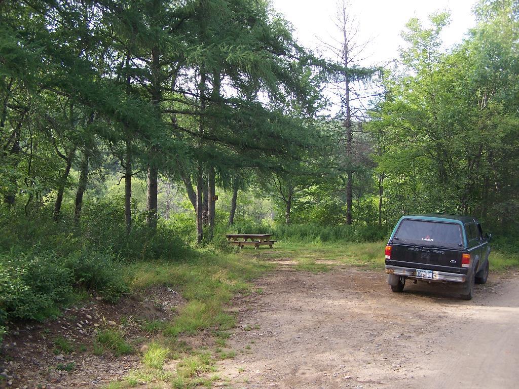
Allegheny National Forest Dispersed Campsites (shown on this map with a round Yellow Camp logo) are free-to-use with a 14-day stay limit in any 30 day period. Many of these campsites are informal areas used for camping, others like along Forest Road 160 and 259 near Jake’s Rocks and along Lolita Grade have enhanced gravel pads/parking areas. Unlike New York State, they do not have formal markings at the sites. More detailed map.
PA DCNR Motor Vehicle Campsites (shown on this map with a Blue Camp logo) are free to stay at with a permit which can now be obtained online, 3 days in advance.
Download a spreadsheet with the coordinates of Allegheny National Forest Dispersed and Motor vehicle campsites.
More About Allegheny National Forest Camping …
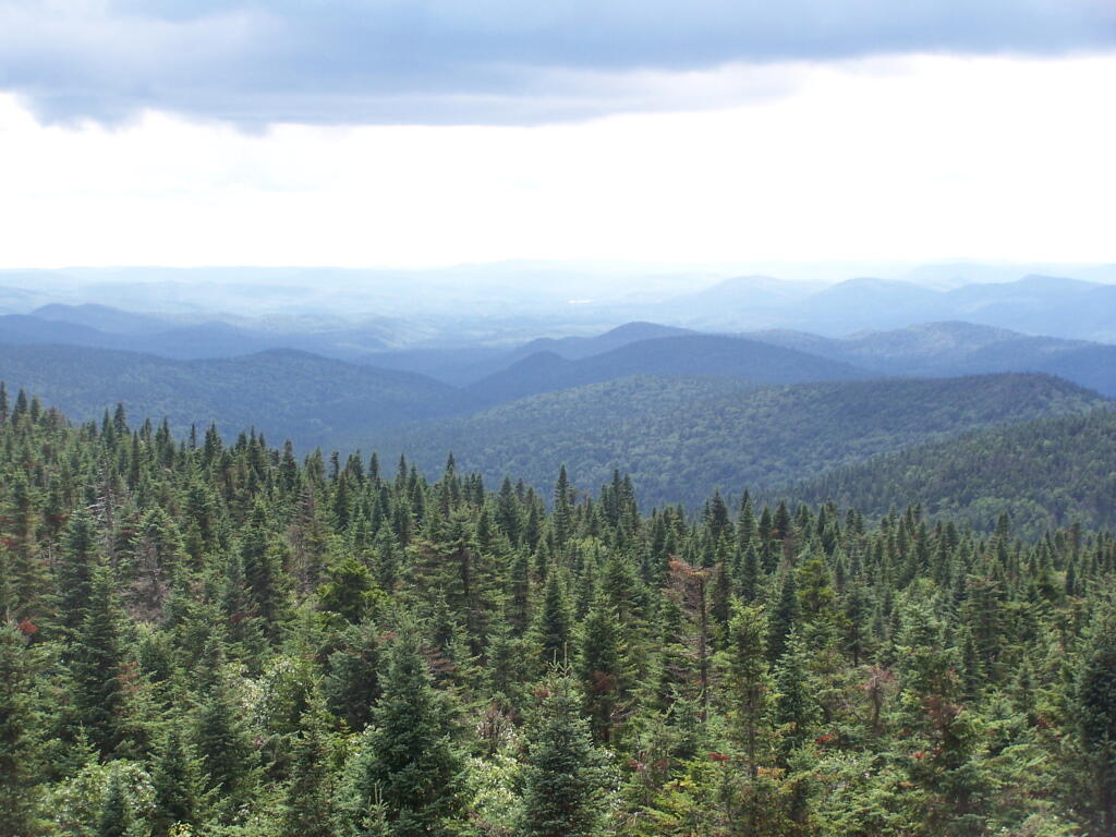
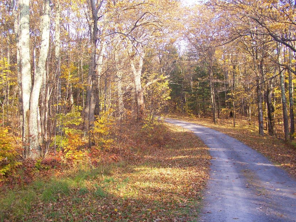
In the Allegheny National Forest there are a variety of back country roads, offering primitive roadside camping.
- Campsites are free to use, and have no facilities except for a fire ring and a pull-off from the road, and sometimes a site reinforced with gravel.
- As noted below, some campsites have additional facilities.
- Don’t make a mess of campsites, pack out any garbage left over.
- Burn only dead and down trees, don’t bring in wood from out of state.
- You can camp up to 14 days per 30 day period in Allegheny National Forest — no permits are required.
Forest Road 160/259 is the most popular dispersed camping area near Jakes Rocks and the Allegheny Reservior. Above are some campsites in this area. Many of these campsites have gravel parking areas and hardend campsites.
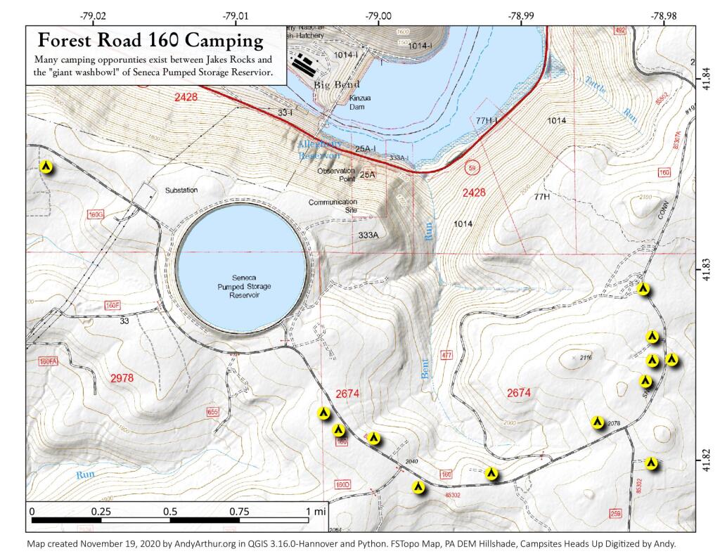
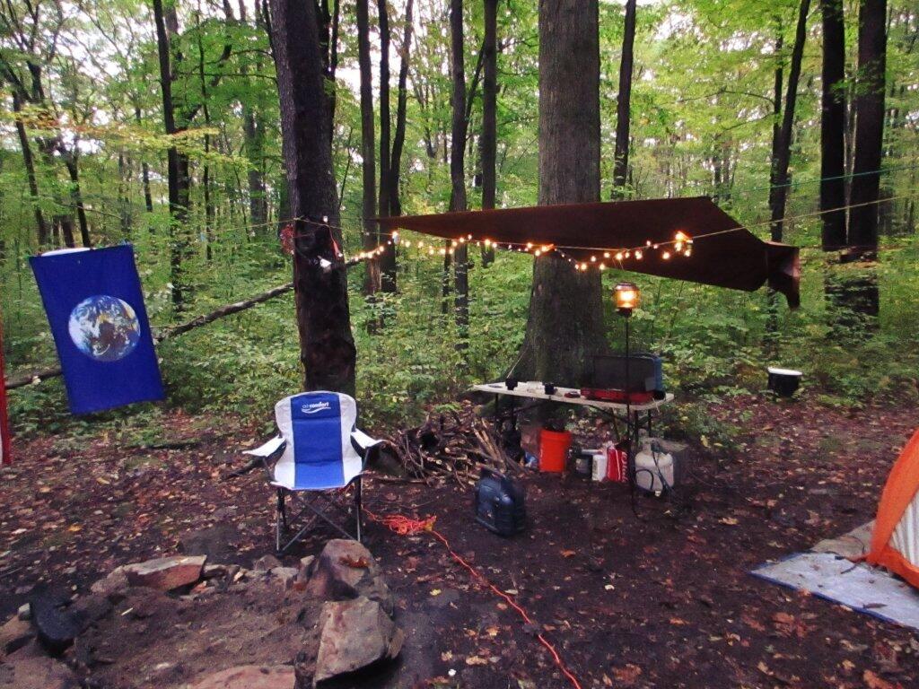
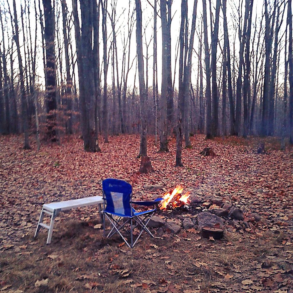
There are several campsites along Loleta Grade, south of Lamonaville (FR 131). This is on the backside of Buzzard Swamp Wildlife Refuge, and is a much more wilderness experience. Many of these campsites have gravel parking areas and hardened campsites. Some of the campsites along the Gurgling Run can be buggy during the summer month, but get much less use then the Jakes Rocks area. Be aware that Forest Road 131 from Loleta Recreation Area to Forest Road 288 is permanently closed due to damage after Superstorm Sandy.
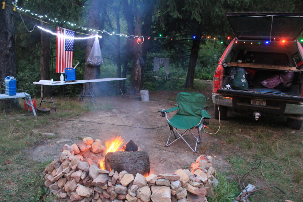
There is a handful of campsites along Fire Road FR 137 along the Dry Run and Whitney Creek near the Willow Creek ATV Area.
There are a handful of campsites along the East Tionesta Creek south of Kane/Shefield.
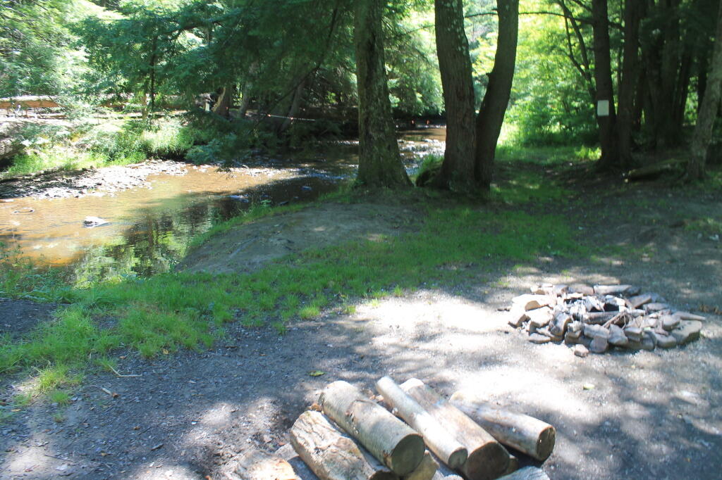
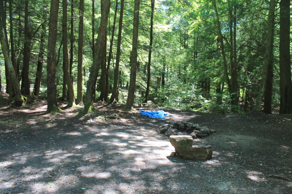
There are many other roads that have camping but these are some of my favorite locations.
More About DCNR Motor Vehicle Camping …
On Pennsylvania State Forests there are a variety of back country roads, offering primitive roadside camping.
- Camping is by free permit which can be requested online
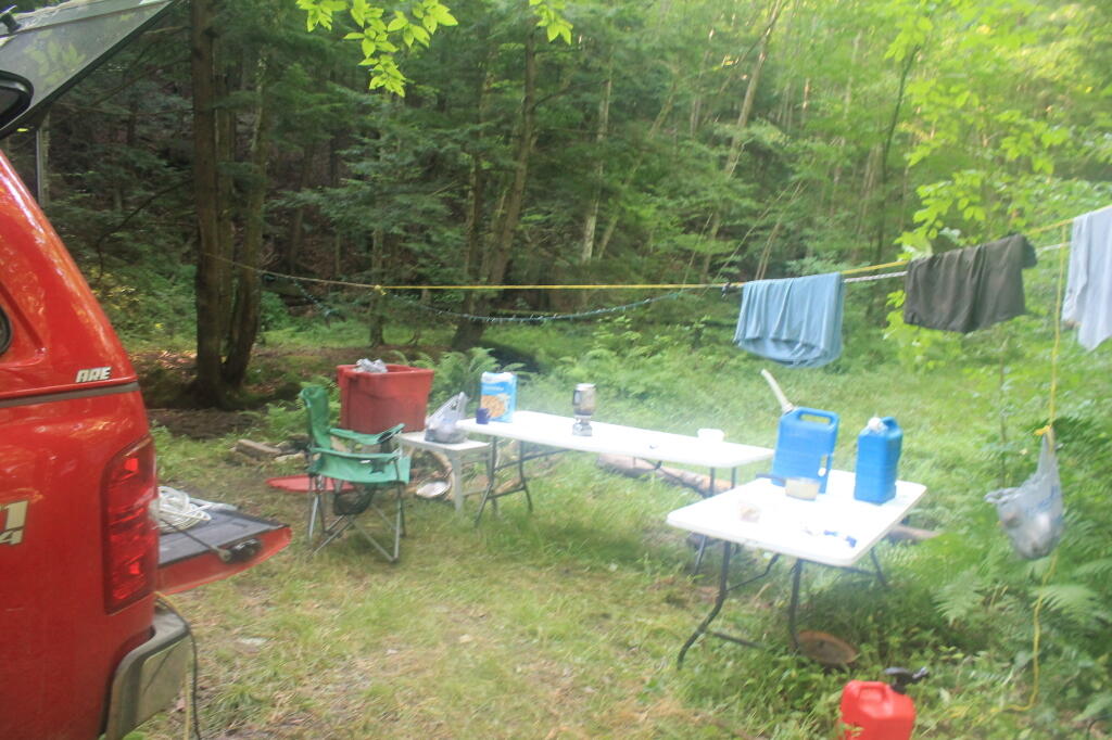
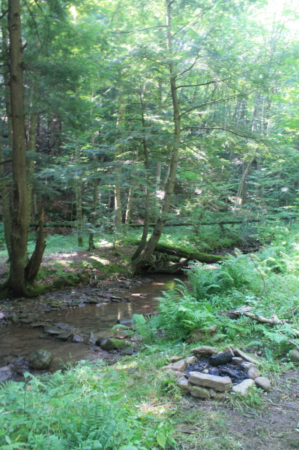
I have not done a lot of DCNR Motor Vehicle Camping, but above is a picture from 2012 when I spent half a week truck camping at Painter Run in the Tioga State Forest near the Pennsylvania Grand Canyon. There are many other opportunities as can be seen above, if you plan ahead and get your permit.
Also, see the DCNR Interactive Map if you are interested in fee campgrounds. They have several “rustic” campgrounds which are inexpensive at $10 night, and do not require reservation. These are traditional campgrounds with hand pump water, pit privies and no electricity but often are well maintained and quiet — although the campsites aren’t spread out like back country camping. Many of these campsites are lightly used off-season and are often a good place to spend a night when traveling.
Allegheny National Forest Dispersed Campsites are free-to-use with a 14-day stay limit in any 30 day period. Many of these campsites are informal areas used for camping, others like along Forest Road 160 and 259 near Jake's Rocks and along Lolita Grade have enhanced gravel pads/parking areas. Unlike New York State, they do not have formal markings at the sites. More detailed map.
PA DCNR Motor Vehicle Campsites are free to stay at with a permit which can be obtained from the local DCNR Forestry office (click on the black dot) during ordinary business hours or by emailing/calling their office with your license plate and contact information.
Links to NYS DEC Webpages on State Land and Topographic Maps 🗺 🌳
Here is an updated list of state land websites for March 2023. The topographic map links will bring you to the latest USGS Topographic Maps for the area, or you can use the listing to bulk download the maps or get the quads you need from USGS Store or your local map seller.
Many of the state lands in New York have DEC websites. Here is an index of all of the webpages about various state lands. Some lands do not have state websites, and therefore do not have links to pages. Updated with UMP, acerage and formatting improvements from DEC data produced March 2016.